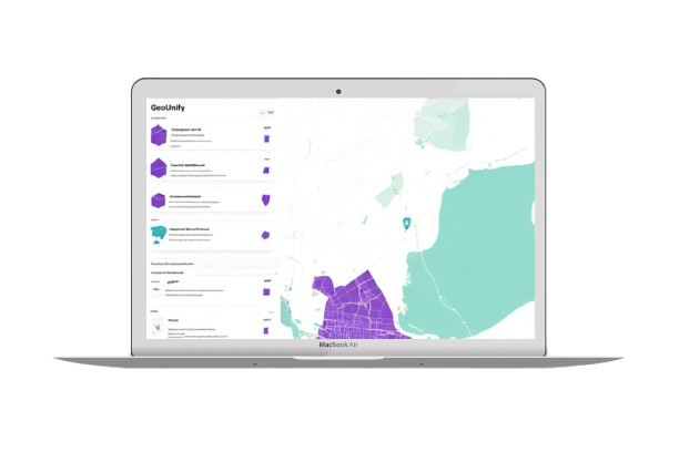
Geounify is an innovative low-code GIS ETL framework that revolutionizes the way geographical data is processed
Designed to integrate, test, verify, and normalize geospatial data, it ensures high-quality, actionable insights in a unified system.
Core Capabilities
Seamless Data Integration
Seamless integration with on-premise and cloud GIS sources, including APIs, remote sensing, spatial databases, and IoT. Flexible architecture enables smooth data ingestion across multiple formats with minimal setup.
Data Quality Assurance
Ensures high-quality spatial data with automated validation, error detection, and correction. Continuously monitors data integrity, applies normalization rules, and maintains consistency across geographic and attribute values.
Efficient GIS Processing
Optimized for large-scale geospatial data transformation, enabling efficient conversion, clipping, mosaicking, and reprojection of raster and vector datasets while preserving accuracy and resolution. Supports GeoTIFF, Shapefiles, Geodatabases, and more.
Spatial Database Integration
Fully compatible with major spatial databases, including PostgreSQL/PostGIS, SQL Server, BigQuery, and Oracle Spatial. Optimized data loading and querying ensure fast access and high-performance analytics.
Intelligent Workflow Automation
Automate GIS data workflows with Python and REST API integrations. Seamlessly integrates with Apache Airflow, GCP Dataflow, Azure Data Factory, and Apache NiFi for real-time and batch processing with minimal manual effort.
Flexible & Secure Deployment
Supports on-premise, cloud (AWS, Azure, GCP), and hybrid deployments. Built with robust security, including role-based access control, encryption, and industry-standard compliance.
Key Benefits
Increased Operational Efficiency
Automate ETL processes, reducing manual data handling and processing time.
Superior Data Accuracy
Ensures consistency and precision, minimizing errors in spatial datasets.
Seamless System Integration
Works with existing GIS, BI, and ETL platforms, ensuring uninterrupted workflows.
Accelerated Development Lifecycle
Low-code approach expedites implementation and customization.
Scalability & Adaptability
Supports high-volume spatial data processing, accommodating growing business needs.
Enterprise Security & Compliance
Ensures robust data governance with industry-standard security protocols.
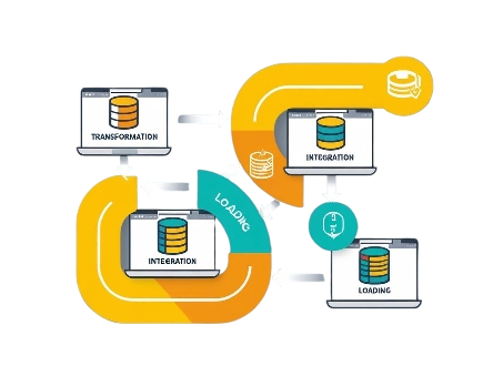
How It Works
-
Extract
Seamlessly ingest geospatial data from CAD files, spatial databases, and GIS platforms, bridging disconnected data silos.
-
Transform
Leverage Python-driven automation and intelligent SQL processing to standardize, validate, and optimize spatial datasets with precision.
-
Scale & Automate
Designed for scalability and distributed processing, our system intelligently manages ETL workflows, ensuring high-performance execution, automated task scheduling, and fault-tolerant operations for seamless geospatial data transformation.
-
Unify & Activate
Integrate data into a harmonized geospatial engine, enabling dynamic analysis, visualization, and seamless cross-platform accessibility.
Supported Data Formats
Vector Data
Shapefiles, Geodatabases, GeoJSON, KML, and more.
Raster Data
GeoTIFF, DEM, satellite imagery, and other raster formats.
Spatial Databases
PostgreSQL/PostGIS, SQL Server, BigQuery, Oracle Spatial, and more.
Flexible Deployment Options
On-Premise
Full control within your secure infrastructure.
Cloud-Based
Deployed on Azure, AWS, or GCP for high availability and scalability.
Microservices Architecture
Modular, API-driven deployment for flexible integration.